Every drive is a road survey.
A phone in a vehicle your council already drives captures the road as it goes. The platform reads every frame for potholes, edge break, faded line marking and cracking, and keeps a ranked defect register your works team can act on. No dedicated survey truck, no annual snapshot that is stale by summer.
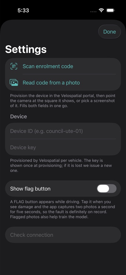
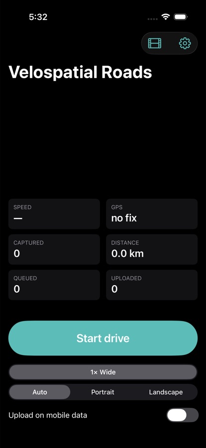
Mount the phone. Press start. That is the whole job.
Each vehicle is enrolled once by scanning a QR code from the portal; no keys to type, no accounts on the phone. On a drive the app captures a frame roughly every ten metres with GPS and time, queues everything on the device, and uploads in batches when there is signal. Uploads over mobile data are a switch the driver controls.
If the phone is offline all day, nothing is lost; the queue drains when it gets home to the depot wifi.
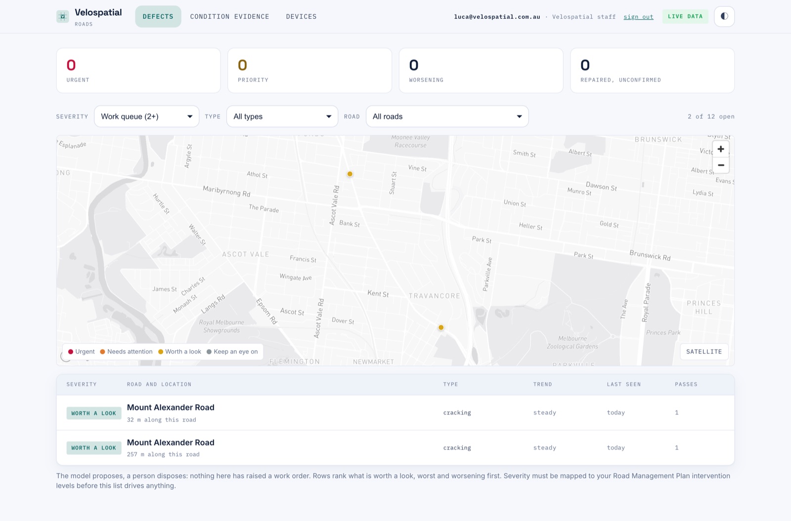
Every fault as a dot on the map, where it was seen
Signed-in council staff open a live register: each defect drawn at the spot it was detected, coloured by severity, with the ranked work queue underneath. Filters cut it by severity, type and road, and the same list drives both the map and the table.
A pothole driven past twelve times is one defect with twelve observations, not twelve defects; identity comes from the road and position, so GPS drift never splits a fault in two.
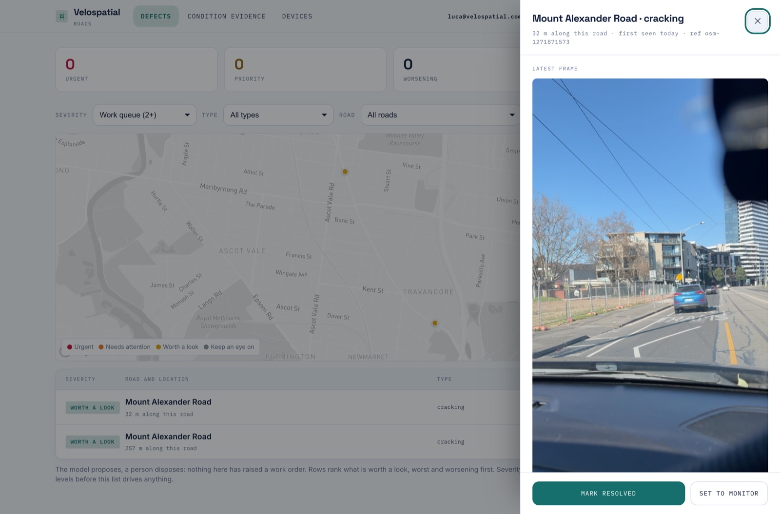
Worsening is the thing you must not be late on
Every defect keeps its observation history: when it was first seen, how it has graded on each pass, and the visual basis for each call. Severity steps up instantly and steps down only when two passes agree, so a road getting worse is never smoothed away by one generous frame.
Three clean passes over a repaired fault close it out as repaired, unconfirmed, and a person confirms. An occluded frame never counts as evidence the pothole is gone.
A frame every ten metres or so, with position, heading and speed, from a phone mounted in any council vehicle.
Each frame is matched to your road network, so a detection belongs to a road and a chainage, not just a coordinate.
AI grades the surface and flags potholes, edge break, faded line marking, cracking, vegetation and debris, each with a severity and the visual basis for it.
Detections join the standing register: same fault on a later pass becomes another observation, a new fault opens a new defect, clean passes count toward repair.
The register ranks what is worth a look, worst and worsening first. Nothing raises a work order by itself; your people decide, with the evidence attached.
Put a phone in one ute and see your roads this week.
A trial runs on your own network with your own vehicles. Severity gets mapped to your Road Management Plan intervention levels before the list drives anything.